One clarification we owe people before anything else: we are Alpine Lakes Lodge, and we are not in the Alpine Lakes Wilderness. We're a private 54-acre property in Easton at I-90 Exit 63, roughly 20 to 40 minutes from several of the wilderness area's southern trailheads. A lot of people land on us while searching for the wilderness itself, so this page is for them.
Below is what you actually need to plan an overnight in the Alpine Lakes Wilderness: which permits are required and which aren't, the campfire rules that surprise people at 4,500 feet, the trailheads worth your drive from the I-90 corridor, and the current fire closure that has shut a large part of the south end.
What the Alpine Lakes Wilderness actually is
The Mt. Baker-Snoqualmie National Forest describes it as approximately 394,000 acres in the Central Cascades, with more than 700 lakes and mountain ponds scattered across glacier-carved granite. It holds 47 trailheads and 615 miles of trails, including 67 miles of the Pacific Crest Trail. It was designated wilderness in 1976.
Two national forests share it. The Mt. Baker-Snoqualmie manages the wet, mossy west side through the Snoqualmie and Skykomish Ranger Districts; the Okanogan-Wenatchee manages the drier, sunnier east side through the Cle Elum and Leavenworth districts. That split matters more than it sounds, because a few of the rules below are different depending on which side of the Cascade crest you camp on.
It also means the wilderness boundary runs right along the top of the corridor most Seattle visitors drive without noticing. If you have taken I-90 to Snoqualmie Pass, you have driven past the front door.
Camping there is free. You still need two pieces of paper.
This trips up first-timers constantly, so here it is plainly.
1. A wilderness permit. Per the Mt. Baker-Snoqualmie's wilderness regulations, "day-use and overnight visitors to the Alpine Lakes Wilderness will need to fill-out a free, self-issue permit available at ranger stations and trailheads." It costs nothing, there is no quota, and there is no reservation. You fill it out at the trailhead box, deposit one portion, and carry the other with you.
2. A parking pass. Nearly every trailhead into the wilderness requires a Northwest Forest Pass or an America the Beautiful pass on the vehicle. The Northwest Forest Pass runs $5 per day or $30 per year. This one gets written up far more often than the wilderness permit does, because it's the piece a ranger can check from the parking lot.
That's the whole system for most of the wilderness. Free permit, paid parking, no lottery, no reservation, show up and walk in.
The Enchantments are the one big exception
The Enchantment Permit Area near Leavenworth operates on a completely separate system, and it is one of the most competitive backcountry permits in the country.
According to the Okanogan-Wenatchee National Forest, all visitors need a permit for overnight stays there from May 15 through October 31. Most permits are allocated through a pre-season lottery held February 15 through March 1 each year, with results posted around March 15. The application fee is $6, non-refundable, and additional days run $5 per person per day up to 14 consecutive days.
A limited number of permits also go out through a daily lottery during the season — but you have to apply the day before, and you must be physically located within one mile of the Wenatchee River Ranger District office in Leavenworth to enter it. That's a geofence, not a formality.
If you're reading this in August hoping to camp in the Core Zone next weekend, the honest answer is that you probably can't. Everything else in the wilderness is open to you tomorrow.
The rules that actually get enforced
Group size is 12 — and horses count. The limit is "12 for a group, in any combination of people and pack and saddle animals." A party of 10 hikers with 3 horses is over. Groups larger than 12 have to split into genuinely separate parties and keep about a mile between them.
Campfires depend on elevation, and the number changes at the crest. The Okanogan-Wenatchee's standing wilderness fire restrictions prohibit campfires above 5,000 feet in the Alpine Lakes Wilderness on the east side, and above 4,000 feet on the west side of the Cascade crest. Since a great many of the destination lakes sit between those two numbers, the practical rule is simple: plan on a stove, not a fire.
Some lake basins are no-fire regardless of elevation. On the Cle Elum district that includes Rachel Lake, Glacier Lake, Spectacle Lake, Ivanhoe Lake, Shovel Lake, Deep Lake, and essentially the whole Upper Park Lake basin. On the Wenatchee River district it includes Hope, Josephine, Leland, Mig, Nada, Trout, Wolverine, and Lake Susan Jane, among others. The ban extends a half mile out from each. Farther west, fires are also banned within a half mile of Talapus, Olallie, Pratt, and Lower Tuscohatchie Lakes.
If you bring stock, grazing, hitching, tethering, or hobbling livestock within 200 feet of a lakeshore is prohibited, and feed must be pelletized or certified weed-free.
Beyond the posted rules, the usual backcountry practice applies: pack out everything including food scraps, camp on durable surfaces well back from the water, and treat every drop you drink.
Where to start, from the I-90 corridor
These are the entries closest to Easton and Snoqualmie Pass. Mileages and elevation figures come from the Washington Trails Association hiking guide.
Talapus and Olallie Lakes — I-90 Exit 45. 6.2 miles round trip, 1,220 feet of gain, topping out at 3,780 feet. A wide, moderate grade that enters the wilderness quickly and reaches two lake basins. This is the one we point beginning backpackers toward. Note that WTA lists the Talapus Lake trail and Forest Road 9030 as closed September 21 through October 31 for trailhead construction.
Snow Lake — I-90 Exit 52, Alpental parking lot. 7.2 miles round trip, 1,800 feet of gain, high point 4,400 feet. It's spectacular, and WTA calls it "Washington's most heavily-used trail in a wilderness area," with the lot filling to capacity on any given Saturday or Sunday. Go on a weekday or start very early.
Rachel Lake — I-90 Exit 62, then Forest Road 4930. 7.0 miles round trip, 2,200 feet of gain, high point 4,600 feet. Steeper and rockier than the mileage implies, with Rampart Ridge and its cluster of small lakes above. Remember that Rachel Lake is inside a half-mile no-fire zone.
Pete Lake — Salmon la Sac area, off Forest Road 4616. 9.0 miles round trip and only 400 feet of gain, high point 3,200 feet. The flattest real backpacking objective in this part of the wilderness, which makes it a good first overnight for kids.
Hyas Lake — I-90 Exit 80 to Salmon la Sac, then 12 rough miles up Forest Road 4330. 4.0 miles round trip, 100 feet of gain. Short, nearly flat, and a classic family overnight — with the caveat that the access road is genuinely rough and, at the moment, closed.
Conditions as of August 21, 2026: the Three Queens Fire
This is the part a guide written last year won't tell you, and it changes the answer for the entire south end of the wilderness.
The Three Queens Fire, burning northwest of Little Kachess Lake, has prompted a large area closure on the Cle Elum Ranger District. The Okanogan-Wenatchee closure order, updated August 11, 2026, runs through October 31, 2026 and covers roughly 40 forest roads and more than 30 trails, "to ensure the safety of the public and firefighting resources."
What that means in practice:
- Rachel Lake, Pete Lake, and Deception Pass trails are closed, along with Kachess, Owhi, Red Mountain, Salmon la Sac, Cle Elum River, Cayuse, Fish Lake, and Wish Poosh campgrounds.
- The Pacific Crest Trail is closed from Snoqualmie Pass to Deception Pass. The Mt. Baker-Snoqualmie notes 50 miles of PCT closed between Snoqualmie Pass and Highway 2, with a Pacific Crest Trail Association walking detour in place.
- Forest Road 4330 to Hyas Lake is closed, which takes the Cle Elum River corridor off the table too.
Talapus, Olallie, and Snow Lake sit west of the closure and were unaffected as of this writing. The Cle Elum Ranger District can be reached at 509-852-1100.
Check these three things before you drive
Closures in this corridor move faster than any blog post. Before you commit to a trailhead:
- The forest alerts pages for Okanogan-Wenatchee and Mt. Baker-Snoqualmie — closure orders are posted there first.
- WTA trip reports for your specific trail. Recent reports catch blowdown, snow lingering at elevation, road washouts, and bugs before any agency page does.
- Current fire restrictions. Stage 1 and Stage 2 public use restrictions are issued separately from the standing wilderness rules and can ban stoves and smoking outright in a bad August.
Backpacking versus basecamping
Not everyone searching for Alpine Lakes Wilderness camping actually wants to carry a pack up 2,200 feet. Both approaches are legitimate, and it's worth being clear about the tradeoff.
Go backpacking if the point of the trip is the wilderness itself — the silence at a granite lake basin at dusk, the alpenglow, a night without a single artificial light. Nothing at a developed campground substitutes for that. Bring a stove, plan on no fire, and expect to share the popular lakes on summer weekends.
Basecamp instead if you're traveling with young kids, dogs who can't do seven miles, someone recovering from an injury, or a group that wants to day hike hard and then have a hot shower. Drive to a trailhead in the morning, hike all day, and sleep somewhere with plumbing.
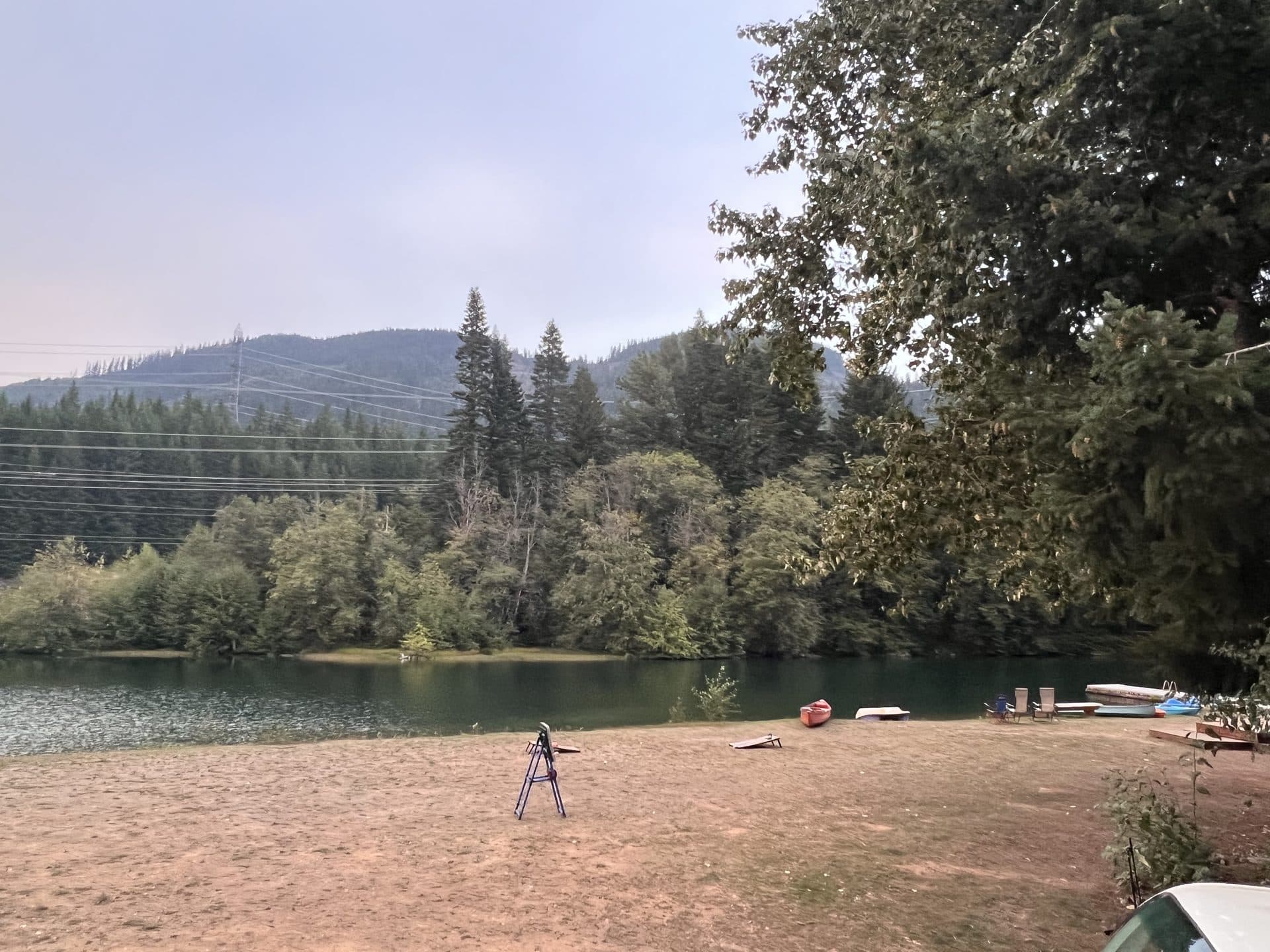
That second option is what we are. Our tent sites and RV sites sit on 54 private acres at Exit 63 with restrooms and showers, and we're open year-round, which almost nothing else in this corridor is. There are also cabins and tiny homes if you'd rather not sleep on the ground at all after a long day out. We have four private lakes with free kayaks, canoes, paddle boards, and paddle boats — a reasonable rest-day option when your legs are done.
For trails that don't require a wilderness permit at all, our guide to hiking trails near Easton, WA covers ten options from flat rail-trail walking to real mountain days. If you're weighing developed campgrounds instead, our camping near Seattle guide compares nine of them with season dates and reservation windows.
One last practical note whichever way you go: cell service disappears east of North Bend and stays gone. Download your maps at home, and leave your trailhead and expected return time with someone who isn't on the trip.
Questions about which trailhead suits your group, or whether the roads are open this week? Give us a call at 425-622-2790. We drive this corridor every day, and we'd rather send you to an open trail than watch you find a closure gate at the end of a forest road.