
Drive twenty-two freeway miles east of us, turn north at Cle Elum, and you enter 50,000 acres of public land that most people passing on I-90 have never heard of. The Teanaway Community Forest is the single largest block of open country near this property, it has 59-site campgrounds that cost nothing beyond a Discover Pass, and in June 2026 it got its first real trail system.
It also does not work like a national forest, and the places people get caught out are all downstream of that one fact.
Why it is public, and why the rules are tighter
In 2013 the state bought this land outright. Forterra, which negotiated the deal, announced it on September 30, 2013: 50,272 acres in the Yakima Basin headwaters, bought from American Forest Holdings LLC, funded with $87 million appropriated by the Legislature in the 2013-15 State Capital Budget plus a $10 million loan from DNR's Real Property Replacement Account. It became Washington's first state-owned community forest. (DNR's current page lists the forest at 50,241 acres — the small difference between that and the 2013 figure is the kind of thing that moves as boundaries get surveyed.)
The important part for a visitor is why it was bought. This was a water deal first, done under the Yakima Basin Integrated Plan, and the management goals DNR publishes still read in that order: "To protect and enhance the water supply and protect the watershed," "To maintain working lands for forestry and grazing," conserving and restoring habitat for fish, expanding recreation consistent with watershed protection, and building community partnerships.
Recreation is fourth on a list of five. That is not a slight — it is the explanation for every rule below. DNR and the Washington Department of Fish and Wildlife co-manage the forest with a community advisory committee, and the result is a place that is genuinely open to the public but asks more of you than federal land does.
The new trail system, opened June 2026
For a decade the honest answer about hiking here was "forest roads and whatever boot paths you find." That changed on National Trails Day, June 6, 2026, when DNR opened the West Teanaway Trailhead and 18 miles of new, nonmotorized trails — Phase 1 of the West Fork Teanaway Trails Plan published in 2022, with, in the Mountains to Sound Greenway Trust's words, "the long-term goal of a 55-mile multi-use trail system in the community forest."
Volunteer organizations built them, and the credits are specific: Kittitas Evergreen Mountain Bike Alliance built the Upper Big Sandy Trail and a climbing trail on Lower Big Sandy, the Washington Trails Association built the Frog Pond Loop, Mountains to Sound Greenway volunteers improved the Cheese Rock Trail, and Backcountry Horsemen of Washington started the Aspen Loop, which carries into Phase 2. Funding came through the state Recreation and Conservation Office.
One wrinkle worth knowing before you plan a distance: DNR's own page still describes the West Teanaway Trailhead as providing access to "15 miles of non-motorized trails," while the June opening announced 18. Both numbers are official and recent. Plan on the smaller one and treat anything extra as a bonus.
Getting there, per DNR: take I-90 Exit 85, follow WA-970 north, turn left onto Teanaway Road, then left onto West Fork Teanaway Road and continue 1.2 miles. From our driveway at Exit 63 that is about 35 minutes. The trails also connect into the Towns to Teanaway system reaching Cle Elum, Roslyn, and Ronald — the same corridor as the Coal Mines Trail we recommend for easy walking.
The longest of the new routes is Big Sandy, which the Washington Trails Association lists at 6.4 miles one-way with 1,670 feet of gain to a high point of 3,570 feet, Discover Pass, dogs allowed on leash. WTA's directions are the ones to follow at the end: head for the yellow gate at the end of the paved cul-de-sac on West Fork Teanaway Road, continue past the gate and across the river, and the trail starts on the right shortly past the bridge.
What is closed right now
This is the section that changes, and the reason to check before you drive.
- Sections of the West Fork Teanaway drainage and its trails are closed "until further notice" for what DNR calls a largescale restoration project. The closure specifically names the USFS West Fork Trail and the USFS Middle Fork Trail. The USFS Yellow Hill trail is open. DNR publishes a closure map on the Teanaway page — look at it rather than guessing, because the new DNR trail system and the older federal trails in the same drainage are not the same thing.
- Middle Fork Road past Indian Camp is closed due to flood damage at the bridge.
- Stay out of burned areas. DNR's wording is that there are "potential remnant hazards from fire operations." The Labor Mountain Fire burned roughly 43,000 acres across the Cle Elum and Wenatchee River ranger districts in September 2025, and the effects are still being worked through: WTA notes that Iron Bear "is not accessible from the Miller-Bear trailhead until further notice" because of damage from that fire.
- Some groomed snowmobile trails out of 29 Pines have temporary closures for wildfire hazards.
Two passes on one road
Drive up the Teanaway far enough and the land changes owners under you without a sign that says so in those words.
On DNR's community forest, a Discover Pass is what you need, and it doubles as the camping fee. Keep going up the North Fork and you cross into the Okanogan-Wenatchee National Forest, where the Esmeralda Trailhead honors the "Digital Day Pass, Northwest Forest Pass, and Interagency Recreation Passes" instead, with day use at $5 per vehicle per day or $30 annually, and a free self-issued wilderness permit at the trailhead on top of that. A Discover Pass on the dash will not cover you there. Which pass covers which lot in this corridor is the whole subject of our guide to Washington recreation passes.
The dog rules flip at roughly the same place. Dogs are fine on the community forest and on the trail to Esmeralda Basin, but the Forest Service prohibits them past the junction 0.4 miles in, on Ingalls Way, Ingalls Pass, and Longs Pass — covered with the rest of the corridor's leash orders in our guide to dog-friendly hikes near Snoqualmie Pass.
Two more hikes worth the drive
- Yellow Hill — 7.4 miles roundtrip, 2,827 feet of gain, high point 5,527 feet, Discover Pass. The one DNR names as open in the West Fork. WTA describes it as "multi-user, somewhat eroded," with views over the West Fork Teanaway valley and out to Rainier and Mount Stuart. Be warned that the 2017 Jolly Mountain Fire turned it from shaded forest into a hot, exposed climb — start early in summer and carry more water than the mileage suggests.
- Iron Bear to Teanaway Ridge — 6.5 miles roundtrip, 1,800 feet, high point 5,489 feet, no pass listed for the Iron Creek trailhead, dogs on leash. This is the wildflower one: balsamroot, penstemon, and paintbrush in late spring and early summer, with Rainier to the south and Mount Stuart to the west from the ridge. Use the Iron Creek approach — the Miller-Bear side is the one closed by fire damage.
Camping, in one paragraph
Three designated areas, all first-come, first-served, all free with a Discover Pass: 29 Pines, Indian Camp, and the Teanaway Camping Area. The rules that catch people are that there is no dispersed camping anywhere in the forest, stays are limited to seven days in a 30-day period, cutting firewood is not allowed, campfires are permitted "in approved designated campgrounds only," and equestrian camping is confined to Indian Camp and the Teanaway Camping Area. Site counts, current conditions, and how these compare to the county's other options are in our Kittitas County camping guide. Mountain bikers should start with our riding guide, since the trail inventory here is actively changing.
When to go, and where we fit
The Teanaway is east of the Cascade crest, lower and drier than anything at the pass, which makes it a spring and fall place as much as a summer one — and a genuinely good answer on a June weekend when the high country is still under snow. Midsummer on a burn-scarred south slope is hot. Winter is for snowmobiles on the groomed trails out of 29 Pines; the corridor's actual Sno-Parks are west of here, in our snow play guide.
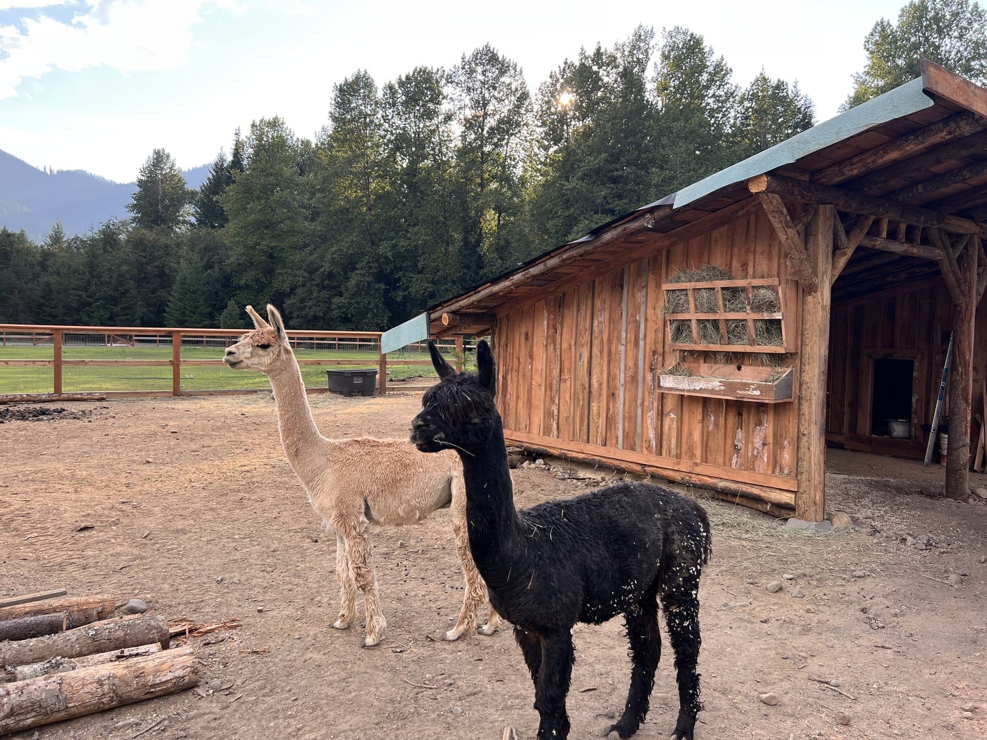
We are at I-90 Exit 63, about 35 minutes from the new trailhead and well under an hour from most of the forest, which makes a Teanaway day easy to run from a cabin rather than from a campsite with no shower. Come back to 54 private acres, four lakes with free kayaks, and the corral. Our hiking page covers what you can walk without leaving the property, and the cabins are hard-sided and heated year-round.
Conditions as of November 13, 2026
- Acreage, management goals, camping rules, trailhead directions, and all closure language are from DNR's Teanaway Community Forest page, which is the authority and is updated as conditions change. The closure map linked there is worth opening before any West Fork trip.
- Purchase figures and the 2013 announcement date are from Forterra's press release; the current acreage figure is DNR's.
- The June 6, 2026 trailhead opening, the 18-mile Phase 1 figure, the 55-mile goal, and the trail-building credits are from DNR's news release and the Mountains to Sound Greenway Trust.
- Trail mileages, elevations, and access notes are the Washington Trails Association's published figures.
- Fire effects in this area are still being repaired and trail access can change between seasons. Call the DNR Southeast Region or the Cle Elum Ranger District at (509) 852-1100 for anything time-sensitive, and 425-622-2790 reaches someone here.